


Robotic Max
Autel Robotics EVO II PRO RTK V3, Real-time Centimeter-Level Positioning, Remote ID, S-ony 1'' 6K/30fps HDR Camera, GNSS Base Station & PPK Support, 38 Minutes, 15KM Transmission, for Mapping/Photogrammetry/Urban Planning/Searching
Autel Robotics EVO II PRO RTK V3, Real-time Centimeter-Level Positioning, Remote ID, S-ony 1'' 6K/30fps HDR Camera, GNSS Base Station & PPK Support, 38 Minutes, 15KM Transmission, for Mapping/Photogrammetry/Urban Planning/Searching
Regular price
$3,499.00 USD
Regular price
Sale price
$3,499.00 USD
Unit price
per
Taxes included.
Couldn't load pickup availability
Autel Robotics EVO II Pro RTK V3

No GCP Required
Autel EVO II RTK V3 can connect to an NTRIP network and does not need GCPs to provide centimeter-grade accuracy.

3rd Party Base Station Support
Autel EVO II RTK V3 supports all NTRIP-compatible base stations.


UPGRADED AUTEL EXPLORER APP IS BORN FOR MAPPING

- 【AUTEL ROBOTICS USA AUTHORIZED】We are the longest and largest distributors of Autel Robotics. Over the years, we have maintained a close partnership with Autel, providing customers with high-quality products and excellent after-sales service. With extensive experience and strong technical expertise in the industry, we are able to offer customized solutions and professional technical support to our customers. All the U-A-V-S we offer include FULL USA WA-RRANTY.📣Please reach out to 💌officialauteldrone @ o u t l o o k . c o m💌 for technical s.upport or assistance.
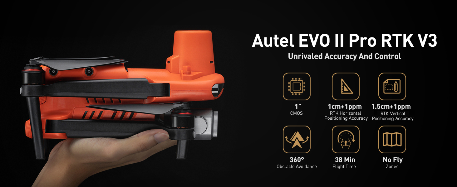
- 【2025 NEWEST RTK MODULE FOR REAL-TIME CENTIMETER-LEVEL POSITIONING】With 1 cm + 1 ppm (horizontal), 1.5 cm + 1 ppm (vertical) positioning accuracy, Autel EVO 2 Pro RTK V3 integrates an entirely new RTK module, which provides real-time centimeter-level positioning data. Our positioning system supports both RTK base station and RTK network, which help provide stable and accurate data acquisition in complex operation environments.
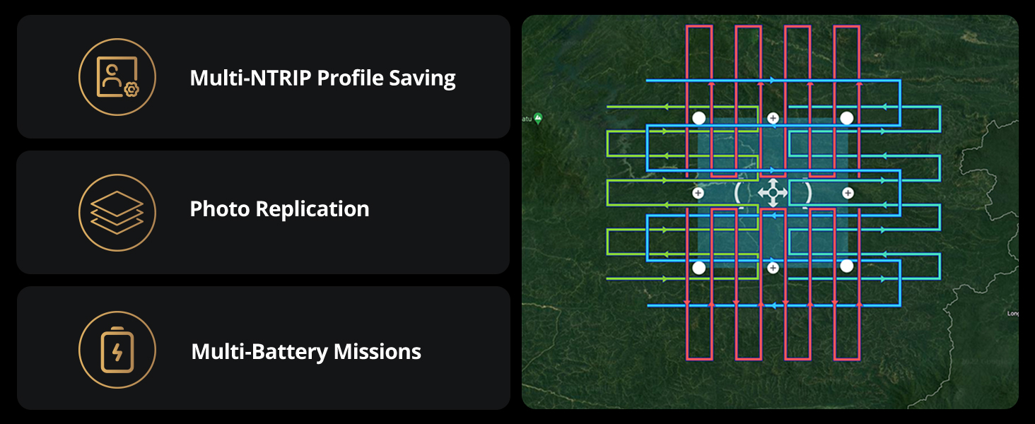
- 【MISSION EXECUTION WITH ADVANCED INTELLIGENCE】After creating a flight route(Waypoint Task丨Rectangle Task丨Polygon Task丨Oblique Photography), the EVO II RTK can fly on the designated flight path autonomously, enabling a smoother, more efficient flight. For repeatable data acquisition missions, you can record the EVO II RTK v3’s previous shooting positions. All the gimbals, camera movements will be replicated, thus producing a full record of the entire mission.
- 【RTK HIGH-PRECISION GNSS BASE STATION】Autel EVO II Pro RTK version v3 supports RTK high-precision GNSS base station to obtain real-time differential data, which makes it possible to obtain the accurate coordinates of the designated target point.
- 【NO NEED FOR GROUND CONTROL POINTS】Autel EVO 2 pro RTK leverages a high precision RTK module, supports PPK and time synchronization, and is not limited by communication links or network coverage, more flexible and efficient to use.
- 【ENVIRONMENTAL ADAPTABILITY】Mapping, Firefighting, Search and Rescue, Law Enforcement, Power Inspection, Traffic Supervision, Environmental Protection and so on, Autel EVO II Pro RTK has the maximum flexibility to help you in all kinds of different missions and Fields.
- 【COMPATIBLE WITH WIDE APPLICATIONS】Autel EVO II Pro RTK provides a proven, accurate, durable, and user-friendly, FAA Remote ID Compliant Unmanned A-i-r-c-r-a-f-t System (UAS) for numerous applications, including the creation of surfaces, point clouds, and orthoimages with Carlson PhotoCapture, as well as feature extraction and CAD plans with Carlson Point Cloud.


